You have got to do St. John. You hear that from everyone who has visited the Island and from those who live here. But, what does it mean to do St. John? Well, there are the wonderful hiking trails that meander through the island that can take you from the “bustling” town of Cruz Bay to secluded beaches and pristine Caribbean forests. How about touring the island on a two-hour tour of the National Park or just go shopping in Cruz Bay? And don’t forget the plethora of beaches.
|
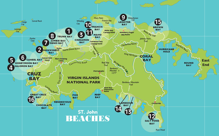
Location on Map
|
BEACH NAME
(click on name to go to detailed description) |
Island Location
|
Snorkeling
|
Beach Chair Rental
|
Watersports Toys
|
Food & Drink
|
Bathrooms
|
Parking
|
Requires a Hike
|
|
|---|---|---|---|---|---|---|---|---|---|---|
| 1 | Trunk Bay | N | • | • | • | • | • | |||
| 2 | Hawksnest | N | • | • | • | |||||
| 3 | Cinnamon Bay | N | • | • | • | • | • | • | ||
| 4 | Salomon Bay | N | • | |||||||
| 5 | Honeymoon Bay | N | • | • | • | • | • | • | ||
| 6 | Caneel Bay | N | • | • | • | • | ||||
| 7 | Denis Bay | N | • | • | ||||||
| 8 | Jumbie Bay | N | • | • | ||||||
| 9 | Leinster/Waterlemon | N | • | • | • | |||||
| 10 | Francis Bay | N | • | • | ||||||
| 11 | Maho Bay | N | • | • | ||||||
| 12 | Salt Pond Bay | S | • | • | ||||||
| 13 | Great Lameshur Bay | S | • | • | ||||||
| 14 | Lameshur Bay | S | • | |||||||
| 15 | Brown Bay | E | • | • | ||||||
| 16 | Great Cruz Bay | W | • | • | • | • |
1. Trunk Bay
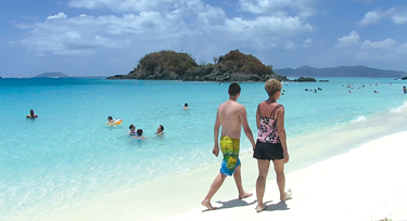 The most popular beach on St. John, Trunk Bay, is known for its 650 feet of underwater snorkeling trail that includes identification signs on the bottom of the sea, describing the coral formations and fish that inhabit the waters. It’s educational and a fun way to spend the day – just follow the signs! You can rent snorkel gear from the water sports center and start your journey from the shore. The beach features showers, restrooms, a food concession, water toy rentals and a gift shop. The beach is part of the National Park and it is the only beach with an admission fee ($4). There are lifeguards on duty. (#1 on map)
2. Hawksnest
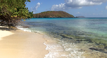 One of St. John’s most convenient beaches, Hawksnest Beach offers picnic tables and barbecue grills. There is also plenty of parking. A great snorkeling reef starts close to shore. (#2 on map)
3. Cinnamon Bay
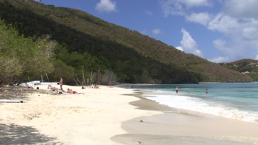 One of the longest beaches in St. John’s National Park is Cinnamon Bay, it is about a mile long. You can snorkel, swim, kayak or participate in other water sport activities. The campground has restrooms, showers, a food concession and water sports rentals. While there is no snorkel trail, there is great snorkeling to the right side of the beach, if you don’t mind the swim or check out the nature trail across from the campground. Explore the old Danish building found along the beachfront. Itis a temporary museum for the National Park Service’s archaeological excavation in the area. (#3 on map)
4. Salomon Bay
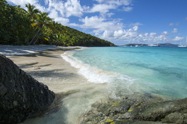 Another favorite with the locals because it is accessible only by trail, either from Caneel Bay or along the Lind Point Trail out of Cruz Bay (about a mile walk, not challenging) and thus is mostly deserted. A perfect place for a relaxing day on the beach. You can easily walk over to Honeymoon Beach where there is a gift shop that sells drinks and snacks and rents water toys. (#4 on map)
5. Honeymoon Beach
Honeymoon Beach is a pretty beach with sandy shoreline surrounded by sea grape and coconut trees. It offers great snorkeling , swimming and lounging. You can access the Honeymoon Beach via the Lind Point Trail which starts just behind the Virgin Islands National Park Visitor Center in Cruz Bay and connects to Caneel Bay Resort. Or you can park in the Caneel Bay parking lot (there is a fee for visitors) and walk over along the coastline from there. VI Ecotours offers a gift shop, restrooms, watersports rentals and daily guided kayak, hike & snorkel multi eco-adventures. Their All Inclusive Relax & Play Fun Pass includes: paddleboard, kayak, snorkel gear, chair, float & locker. Reserve in advance by calling 340.779-2155 or book online at viecotours.com. Use promo code: “STTWL” when booking. (#5 on map)
6. Caneel Bay
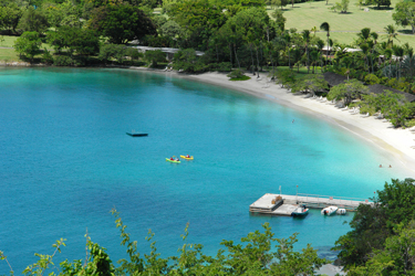 Caneel Bay Beach can be hiked to from Cruz Bay along the Lind Point Trail. It is the ultimate white sand beach. The water is usually very calm and shallow, perfect for a day of swimming and sunning. All Virgin Island Bebeaches are open to the public up to the high tide mark. You can also take a car and park in the Caneel Bay parking lot. But if you want to use the resort’s facilities you will have to check in with the front desk to pick up a day-pass and day visitor’s guide and there may be a fee. There is a watersports concession that rents sailboats, kayaks, sups, snorkel gear and other small water toys. (#6 on map)
7. Denis Bay
To access Denis Bay you will take the Peace Hill Trail to this lovely white sand beach. Not usually very many people, if any, there as it is hard to get to. You have to hike or get there by boat. It is within the National Park boundaries. There are no facilities. (#7 on map)
8. Jumbie Bay
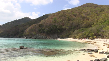 Jumbie Bay is a lovely little beach with a short stretch of white sand fringed with sea grapes. If you’re looking for a small, private, intimate beach without having to walk a long trail to get there, then Jumbie is an excellent choice. A walk down wooden steps and a short trail leads you to the beach from the main road. The parking is limited. A small, almost obscure sign on the road indicates the beach. Snorkeling can be enjoyed on calm days a long a shallow reef that extends from the right side of the beach. (#8 on map)
9. Leinster Bay and Waterlemon Cay
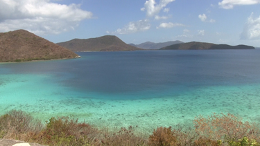 You can reach Leinster Bay by boat or by hiking a short 15 or so minutes from the parking lot. Mangrove trees line the left side of the bay. The shoreline is pebbly with a few sandy areas that can be used to enter the water for a swim. Another 10 minutes down the trail is Waterlemon Bay which has a lovely, quiet beach. There is excellent snorkeling around Waterlemon Cay. Walking along the rocky coast to the tip of the bay will allow you to access the cay with a shorter swim. Look out for turtles, starfish and stingrays. (#9 on map)
10. Francis Bay
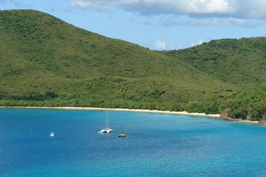 Francis Bay is one of St. John’s longest beaches. Long white sand beach with calm, clear water protected from the easterly winds. Portable toilets are located in the main parking. Picnic tables and barbecues can be found at the edge of the beach. The Francis Bay Trail runs along a salt pond and offers great bird watching. There is good snorkeling for beginners on the west end, towards Maho Bay. For experienced snorkelers go to the rocky section at the other end of the beach. (#10 on map)
11. Maho Bay
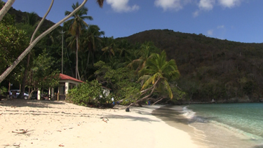 Maho Bay is great for children. The water is shallow and protected. If you take a full-day sail to St. John, you may visit Maho Bay. Look carefully in the sand while snorkeling; you might see a stingray, just look for the outline in the sand. (#11 on map)
12. Salt Pond Bay
This scenic bay on St. John’s south shore offers a secluded beach with good swimming and snorkeling. Are you willing to “rough it” a bit to go off the beaten path? You will have to take a taxi or park on a hill and hike down for about 10 minutes to the water. You will probably be the only ones there. There are several hiking trails, one of which leads to a salt pond. (#12 on map)
13. Great Lameshur Bay
A local favorite because this beach is difficult (a mile from the entrance on a very rough, dirt road) to get to and usually doesn’t have many people on it. Most will pass it by and continue on to Little Lameshur Bay. This beach is good for snorkeling but not so great for just swimming as it is made up of stones and pebbles. It should probably only be snorkeled by more seasoned snorkelers and should be approached with caution as you get closer to the point where waves can get quite large. (#13 on map)
14. Lameshur Bay
On the south shore, just past Great Lameshur Bay, you’ll come to Lameshur Beach. There are usually plenty of places to park close to the beach. You’ll find several picnic tables and BBQ grills. Little Lameshur is a protected sand and rubble beach. Somewhat isolated due to the long drive required to get there the bays are often sparsely populated. The bottom is mostly sand with some patches of sea grasses. Out from the shore it becomes all sea grass which increases your chances of seeing sea turtles and rays. The bay doesn’t get large surf unless the wind is out of the south. (#14 on map)
15. Brown Bay
The easiest way to get to Brown Bay is by a 30 minute hike from the Brown Bay Trail, located just off East End Road (Rte 10). It is literally, one of the off-the-beaten-path beaches. The beach at Brown Bay is sandy and wind swept with plenty of shade along the narrow sand and pebble shoreline. The water is a mix of sandy bottom and sea grasses. (#15 on map)
16. Great Cruz Bay
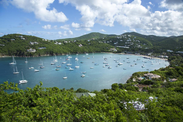 This is the beach of the Westin Resort and is, as such, well manicured and kept up. You can rent watertoys, use the water trampoline, beach chairs and umbrellas. There isa nice poolside cafe where youcanget lunch. This is a great beach for kids. The water is calm with a mostly sandy bottom with some seagrass patches. (#16 on map)
